High resolution thermal data from space for a safer and more sustainable Earth

Book a demo
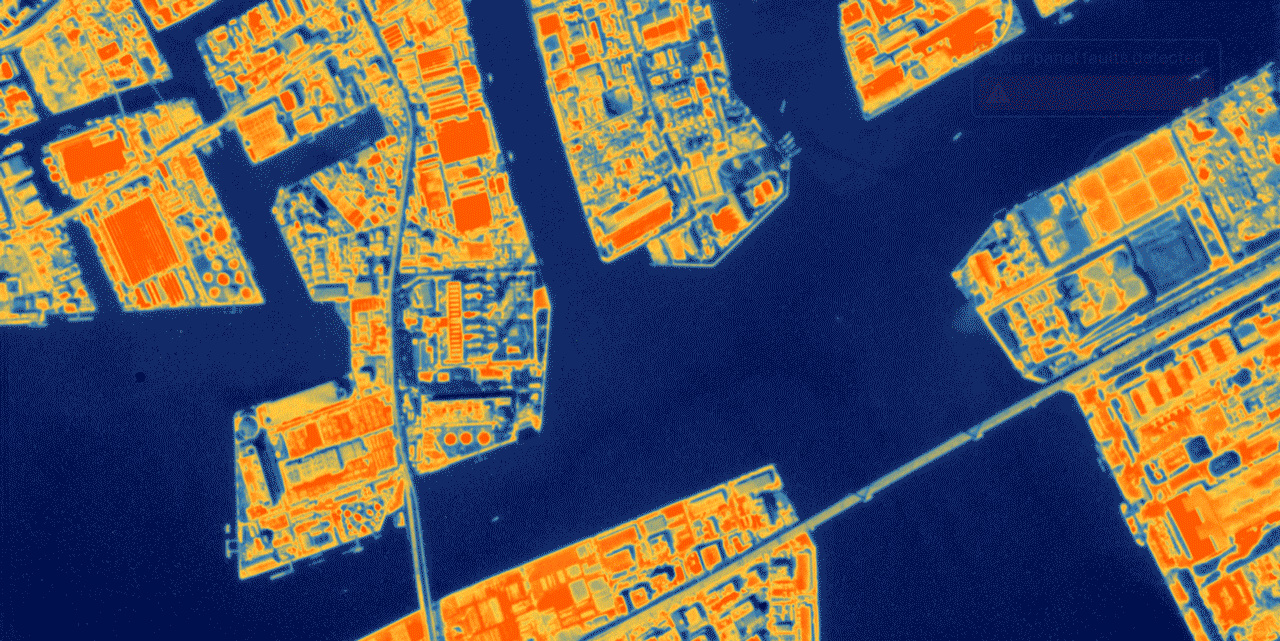
Thermal map of a city captured by Thermal SAT

Unparalleled 3.5 m resolution

We are providing the world's highest resolution thermal satellite imaging capability, providing deep insights for a range of commercial applications.

Our data enables organisations to make intelligent, data-driven decisions that will propel their operational efficiency and sustainability.

Unlocking insights that existing technologies can't

Visible light imagery of an urban area

Visual imagery isn't enough to see the hidden thermal signature.

Low resolution thermal dataset example

Current thermal datasets are too low resolution, restricting visual applications.

High resolution thermal image of a city skyline

Thermal SAT's 3.5m resolution enables deeper insights into the hidden details of any structure.

Discover the technology

Thermal Insights

Within a Thermal SAT thermal image, each pixel is a temperature measurement, offering unparalleled detail. Change is not only detected, it's quantified. Our data is critical for driving efficiencies and discovering what can't be seen with the naked eye.

Thermal insights map showing temperature measurements across a city
Monitor industrial activity Activity level over time
Verify building insulation Identified heat loss
Detect sub-surface activity Anomalies detected
Thermal view supporting national security operations

National security

Enhance intelligence gathering capabilities with thermal imagery.

Thermal view of the built environment

Built environment

Drive intelligent development strategies backed by high resolution thermal data.

Thermal view supporting climate resilience

Climate resilience

Gain essential insights for climate risk assessment and sustainability reporting.

Sectors

Thermal SAT satellite in orbit

Our constellation

Launched in June 2023, HOTSAT-1 is the first in our planned constellation of eight satellites. We are currently preparing for the launch of HOTSAT-2 in 2024.

Thermal SAT has established a highly successful supply chain to build and launch high quality, high resolution thermal imaging satellites.

Read the news

Features

High resolution thermal imagery captured at 3.5m resolution, enabling actionable insights into previously invisible activities.

Global accessibility allows data capture over any location on Earth, ensuring no target is out of reach, day or night.

High revisit times enabled by our planned constellation of 8 satellites, ensuring you stay updated on rapid developments as they happen.

Read the tech specs

Use cases

Explore how Thermal SAT's data can transform your operations.

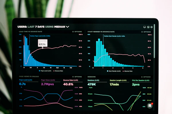
Dashboard monitoring economic activity with thermal data
Monitor economic activity at a granular level
Building inspection for heat loss using thermal imagery
Validate building insulation and detect heat loss
BBC
Sky NEWS
BusinessGreen
nature

Latest news

See all news
Thermal SAT launches first commercial thermal satellite

Thermal SAT launches first commercial high resolution thermal satellite, HOTSAT-1...

Critical design review completed for HOTSAT-2

Thermal SAT successfully completes critical design review for HOTSAT-2...

Upcoming events

Meet our team at industry events.

GEOINT 2024 Symposium

GEOINT

2024 Symposium

Space Tech Expo Europe

Space Tech Expo

Europe

Contact Thermal SAT

Get in touch to discover how our data can support your organisation.

Reach out for a chat with our team, or request a sample dataset.

Thank you — your message has been received.

By submitting this form, you acknowledge that you have read and understand our Privacy Policy.

About Thermal SAT

We are building the world's most capable thermal imaging satellite constellation.

Thermal map produced by Thermal SAT

Our story

Thermal SAT was founded with a single purpose: to make the invisible visible. Our thermal imaging satellites capture the heat signature of every structure on Earth, at a resolution that has never been possible before.

From our headquarters in London, we design, build and operate a growing constellation of satellites that deliver actionable thermal intelligence to governments and enterprises around the world.

Mission, vision and values

Our mission

To deliver high resolution thermal data that helps protect people, resources and the planet.

Our vision

A world where every decision about energy, infrastructure and climate is informed by thermal data.

Our values

Precision, transparency and partnership guide everything we build.

Thermal SAT at a glance

3.5 m
Metre resolution
8
Satellites planned
24/7
Day & night imaging
2023
First launch

Milestones

2016

Company founded in London

2023

HOTSAT-1 launched into orbit

2024

HOTSAT-2 in final preparation

2026

Full constellation of eight satellites

Solutions

Thermal intelligence for the decisions that matter most.

What we deliver

Energy and infrastructure thermal monitoring

Energy & infrastructure

Monitor pipelines, power plants and industrial sites in near real time, detecting anomalies before they become failures.

Built environment thermal analysis

Built environment

Verify insulation performance, map heat loss across entire cities and prioritise retrofit investment.

Climate resilience thermal data

Climate resilience

Quantify urban heat islands, monitor wildfire risk and build evidence for sustainability reporting.

National security thermal intelligence

National security

Detect activity that visible imagery cannot see, day or night, through cloud and smoke.

Economic activity monitoring dashboard

Economic activity

Track production, logistics and construction activity as an independent measure of economic output.

Insurance and risk assessment with thermal data

Insurance & risk

Assess property and portfolio risk with objective thermal evidence gathered from orbit.

How it works

1

Task

Tell us where and when. Our team schedules your acquisition within the satellite's orbit.

2

Capture

The satellite records a calibrated thermal image at 3.5 metre resolution.

3

Deliver

Data is processed and delivered to your team as analysis-ready thermal intelligence.

Talk to our team
Thermal SAT satellite constellation

Our constellation

Launched in June 2023, HOTSAT-1 is the first in our planned constellation of eight satellites. We are currently preparing for the launch of HOTSAT-2 in 2024.

Thermal SAT has established a highly successful supply chain to build and launch high quality, high resolution thermal imaging satellites.

Read the news

Sectors

Thermal data, applied to the sectors that shape our world.

Thermal imagery supporting national security

National security

Thermal infrared reveals activity that visible imagery misses. Our data supports analysts working on monitoring, verification and situational awareness.

Imagery is captured day or night and can be tasked over denied or remote areas.

  • Day and night imaging
  • Cloud and smoke penetration
  • 3.5 m resolution
Thermal analysis of the built environment

Built environment

Identify heat loss at building level and city scale. Thermal SAT data turns every rooftop into a measurable data point.

Planners, asset owners and energy companies use our data to prioritise retrofit and prove performance.

  • Roof-level heat loss detection
  • Retrofit prioritisation
  • Performance verification
Thermal data supporting climate resilience

Climate resilience

Measure urban heat islands, monitor industrial emissions and track the thermal health of landscapes over time.

Our data provides the objective evidence base required for climate risk assessment and disclosure.

  • Urban heat island mapping
  • Industrial emissions monitoring
  • Sustainability reporting

Sectors

Book a demo

News & events

The latest from Thermal SAT.

Latest news

Thermal SAT launches HOTSAT-1

Thermal SAT launches first commercial high resolution thermal satellite, HOTSAT-1...

Critical design review for HOTSAT-2

Thermal SAT successfully completes critical design review for HOTSAT-2...

Multi-year data agreement with European energy operator

Thermal SAT signs multi-year data agreement with European energy operator...

New ground segment processing facility

Thermal SAT expands ground segment with new processing facility...

As featured in

BBC
Sky NEWS
BusinessGreen
nature

Upcoming events

Meet our team at industry events.

GEOINT 2024 Symposium

GEOINT

2024 Symposium

Space Tech Expo Europe

Space Tech Expo

Europe

Contact us

Let's talk about what thermal data can do for you.

Contact Thermal SAT

Get in touch to discover how our data can support your organisation.

Reach out for a chat with our team, or request a sample dataset.

  • London, United Kingdom
  • info@thermalsat.net
  • Mon – Fri, 09:00 – 18:00 GMT
Thank you — your message has been received.

By submitting this form, you acknowledge that you have read and understand our Privacy Policy.

Login to Thermal SAT

Welcome back. Access your thermal data dashboard.

Don't have an account? Register

Protected area. Authorised users only.

Create your account

Start exploring high resolution thermal data today.

Already have an account? Login

A free 30-day subscription is created automatically.

Thermal SAT Educational & Technical Resource Library

Practical guides, radiometric benchmarks, worked thermal calculations, and operational checklists for 3.5 m longwave infrared satellite imagery across built environment, energy, climate, and security workflows.

Sensor Physics & ResolutionUnderstanding 3.5 m Thermal Infrared Satellite Imagery: Physics, Spatial Detail, and Use CasesExplore how 3.5 metre thermal infrared ground sample distance overcomes mixed-pixel averaging in legacy orbital sensors to deliver asset-level temperature measurements.Radiometry & CalibrationBrightness Temperature vs. Land Surface Temperature: Emissivity and Atmospheric CorrectionUnderstand the radiometric pipeline that transforms at-sensor longwave infrared radiance into physically accurate surface temperature across diverse urban and industrial materials.Built EnvironmentCity-Scale Building Heat Loss Detection and Roof Insulation Verification from OrbitDiscover how municipalities, housing associations, and commercial asset owners use 3.5 m nighttime thermal imagery to rank roof insulation performance across thousands of properties.Climate ResilienceHigh-Resolution Urban Heat Island Mapping for Municipal Climate AdaptationLearn how 3.5 m daytime and nighttime thermal imagery measures parcel-scale Surface Urban Heat Islands to guide urban forestry, cool-pavement pilots, and heat-wave resilience.Energy & InfrastructureThermal Satellite Monitoring for Pipelines, Power Plants, and Industrial AssetsExplore how high-resolution thermal Earth observation detects pipeline leaks, cooling water discharge plumes, flare operations, and electrical hotspots across remote energy networks.National Security24/7 Day-and-Night Thermal Infrared Intelligence for Security and Situational AwarenessUnderstand how passive longwave infrared satellites overcome darkness, camouflage netting, and smoke to deliver continuous activity intelligence over remote or denied areas.Economic IntelligenceMeasuring Industrial Output and Economic Activity with Thermal Satellite Time SeriesLearn how financial analysts, commodity desks, and macro researchers convert multi-temporal 3.5 m thermal measurements into independent indicators of production and capacity utilisation.Infrastructure DiagnosticsDetecting Sub-Surface Leaks, Geothermal Plumes, and Underground Activity with Thermal DataDiscover how subtle ground-surface temperature anomalies reveal buried utility leaks, subsurface combustion, and underground thermal processes at 3.5 m orbital resolution.Constellation & OperationsSatellite Tasking, Orbit Geometry, and Revisit Cadence in Thermal ConstellationsExamine how multi-satellite LEO thermal constellations improve revisit frequency, navigate cloud-cover risk, and streamline the Task, Capture, and Deliver workflow.ESG & Climate RiskWildfire Thermal Risk, Industrial Heat Emissions, and Objective ESG Disclosure EvidenceLearn how 3.5 m thermal infrared imagery supports pre-fire stress tracking, smoke-piercing active fire mapping, industrial emissions verification, and audit-grade climate disclosure.Insurance & RiskOrbital Thermal Data for Property Underwriting, Portfolio Risk, and Loss PreventionExplore how property insurers, reinsurers, and asset managers integrate 3.5 m thermal intelligence into roof condition underwriting, electrical fire prevention, and catastrophe risk pricing.Data Engineering & GISIntegrating Analysis-Ready Thermal Imagery into GIS, Cloud GeoTIFF, and Analytics PipelinesA practical engineering guide to data processing levels, 16-bit Kelvin scaling, Cloud Optimized GeoTIFF (COG) streaming, STAC discovery, and automated zonal statistics over vector polygons.